
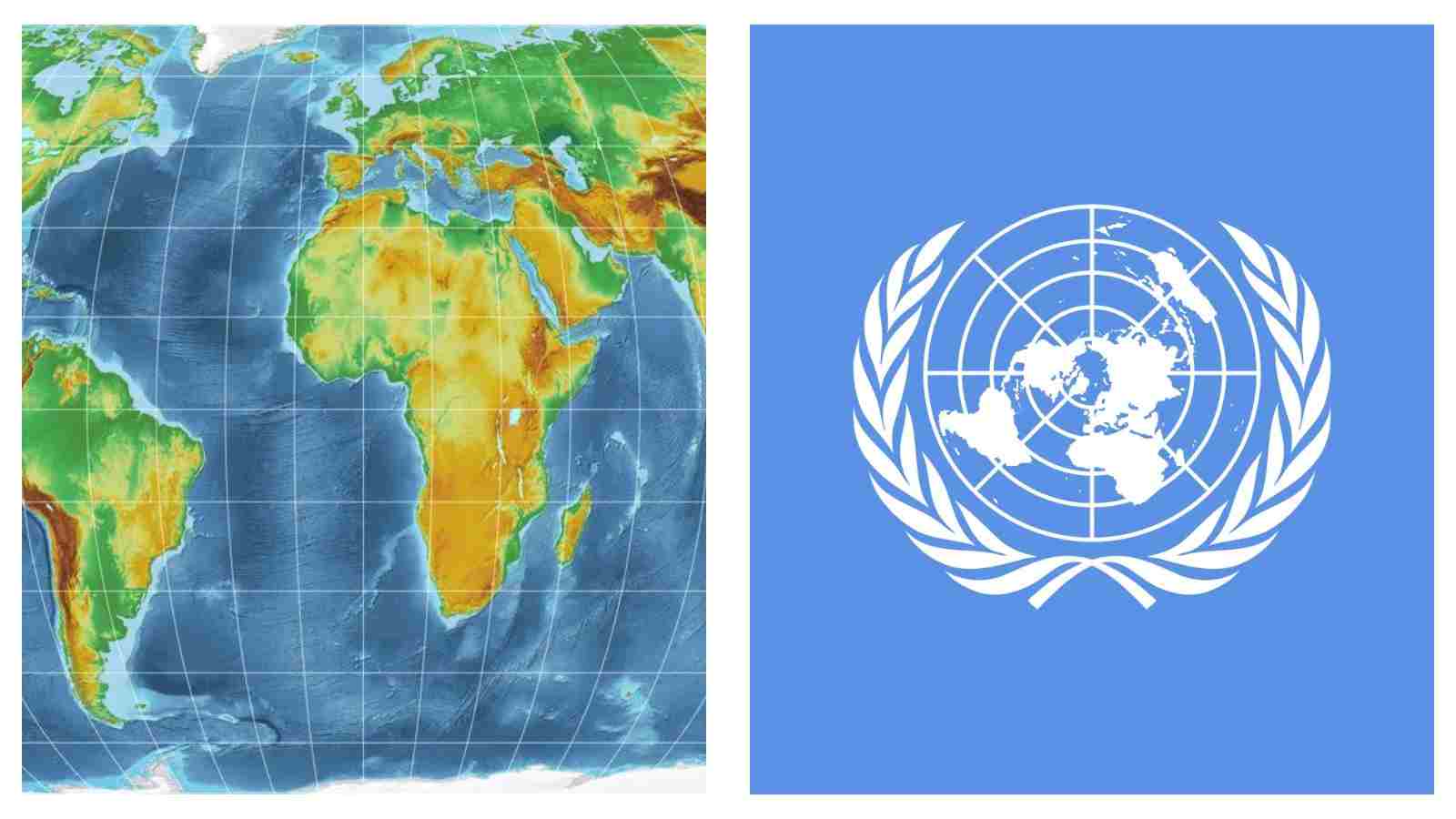
For generations, the world map has been making Greenland appear almost as large as Africa. That map is now being challenged to change by the United Nations.
The UN General Assembly has voted to encourage the wider use of a new world map projection that more accurately represents the relative size of countries and continents, addressing distortions that have shaped how much of the world has been depicted for centuries.
The resolution, led by Togo with support from African Union countries, was approved on Friday with 164 countries voting in favor.
The United States was the only country to vote against it, while six countries abstained.
At the heart of the change is the Equal Earth projection, which gives landmasses their correct proportions rather than enlarging areas closer to the poles.
The problem with the map we know
The familiar Mercator projection dates back to 1569, when Flemish cartographer Gerardus Mercator developed it primarily as a tool for navigation.
Its usefulness for sailors came with a trade-off.
Because the Earth is round and a flat map cannot perfectly represent its surface, the Mercator projection stretches areas as they move toward the poles.
Countries and regions in higher latitudes therefore appear much larger than they actually are, while areas closer to the equator appear smaller.
The difference becomes particularly striking when looking at Africa and Greenland.
On the Mercator projection, the two can appear roughly comparable in size. In reality, Africa is about 14 times larger than Greenland.
The distortion does not mean the Mercator map is geographically useless. Its design was created for navigation, where preserving directions was particularly important.
But the map’s continued use in classrooms, media and other settings means its visual distortions can also influence how people perceive the relative size of different parts of the world.
That is where the UN’s new resolution comes in.
READ MORE INTERNATIONAL NEWS: The Philippines invites Filipino-Americans to tour homeland in 2027

A different way of seeing the world
The resolution promotes the Equal Earth projection, which was introduced in 2018 and is designed to preserve the relative area of landmasses.
Unlike the Mercator projection, Equal Earth shows continents according to their actual proportions.
Africa consequently takes up a much larger share of the map.
The change is not simply about producing a different-looking graphic. The campaign behind it argues that the way countries are represented visually can influence how people understand the world around them.
Togo led the push at the United Nations, backed by the African Union, with supporters arguing that the long-standing distortions have contributed to an inaccurate perception of Africa and other regions closer to the equator.
Before the vote, Togolese Foreign Minister Robert Dussey argued that maps influence education and collective perceptions, making the way the world is represented more consequential than it might initially appear.
The resolution therefore frames the issue not simply as a cartographic preference, but as a question of how geographic information is presented to the public.
MORE FROM LEVI MORA: From ‘Obsession’ to the Oscars, Inde Navarrette is on a roll
The vote changes the map — but not overnight
The UN decision does not ban the Mercator projection. The resolution is not legally binding, meaning governments, schools, companies and technology platforms are not required to immediately stop using it.
Instead, it encourages wider adoption of Equal Earth and other projections that more accurately represent land areas.
The result itself was decisive: 164 countries backed the resolution, with the United States voting against it and six countries abstaining.
For supporters of the campaign, the significance lies less in replacing one piece of paper with another than in correcting a visual representation that has been around for centuries.
READ NEXT: France, South Korea pledge EUR1bn to back indie cinema as Macron, Lee raise alarm over AI in films
 Angelica N. Hall
  Kamille Q. Cabreza
  Geoffrey H. Latayan